|
The Experimental Program to Stimulate Competitive Research (EPSCoR) is a National Science
Foundation program directed at states that have historically received lesser amounts of
research and development (R&D) funding. Through this program, states develop partnerships
between their higher education institutions, industry, government, and others to effect
lasting improvements in their R&D infrastructure, capacity, and national competitiveness.
Maine EPSCoR at the University of Maine oversees and implements the state's NSF EPSCoR
program.
SEANET was established under a five-year award (2014-2019) to help understand how we can
create more sustainable coastal communities and ecosystems through a deeper understanding of
how these systems interact with and influence each other. This multi-institutional,
public-private partnership led by the University of Maine in collaboration with the
University of New England and other institutions in Maine uses Maine's 3,500 mile coastline
as a living laboratory to study physical oceanography, biophysical, biogeochemical,
socio-economic, and policy interactions that have local, bioregional, national, and global
implications. The project applies a new focus of looking at Maine's inshore waters as
aquaculture growing areas.
Maine EPSCoR is mobilizing the collective capacity of Maine's coastal science resources
to establish SEANET, a research network focused on Sustainable Ecological Aquaculture (SEA).
SEANET is taking a multi-institutional, transdisciplinary research approach to gain a
comprehensive understanding of how SEA can interact with coastal communities and ecosystems.
The SEANET research program uses the field of sustainability science to understand the
social and environmental connections and feedback loops among SEA, and coastal communities
and coastal ecosystems. For more information, visit
http://umaine.edu/epscor/maine-epscor-programs/seanet/
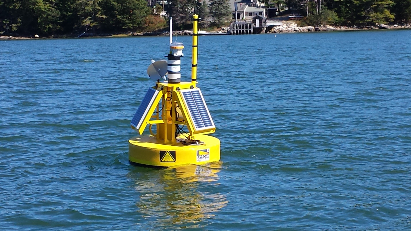
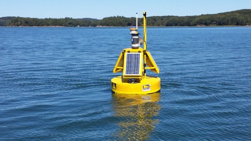
Part of the research and education program involves developing oceanographic models of
factors which control the productivity of Maine's coastal waters in three bioregions
(southern, central and down east Maine), supplemented by hourly monitoring of biophysical
parameters in 6 coastal regions through LOBO buoys in the more sheltered waters, and at the
mouths of the bays in more exposed conditions using buoys developed at the University of
Maine. During the fall of 2015 and throughout 2016, 2 LOBO and 1 U Maine buoys are deployed
in the Damariscotta River estuary (upper and middle LOBO, outer U Maine) and the Saco Bay
region (Saco River and Scarborough Marsh LOBO, Saco Bay U Maine). During 2017, buoys were
moved to sites in Casco Bay (New Meadows River upper and middle LOBO, outer U Maine), the
Bagaduce River (upper LOBO, outer U Maine), and the upper Damariscotta River estuary (LOBO).
During 2018, buoys are deployed in Machias Bay (eastern LOBO and western U Maine), Cobscook
Bay area (South Bay and Western Passage LOBO, Eastport shipping channel U Maine), and the
upper Damariscotta River estuary (LOBO).
Historical U Maine data can be found at:
Damariscotta: http://gyre.umeoce.maine.edu/data/gomoos/buoy/html/E05.html
Saco: http://gyre.umeoce.maine.edu/data/gomoos/buoy/html/C05.html
Casco: Casco: http://gyre.umeoce.maine.edu/data/gomoos/buoy/html/D03.html
Bagaduce: http://gyre.umeoce.maine.edu/data/gomoos/buoy/html/F03.html
Each bay region will have 1 or 2 LOBO buoys, depending on accessibility, and 1 UMaine
buoy for 1 year. The current UMaine buoys are located in Western Machias Bay and Eastport,
and the data can be found at: Coming Soon
The SEANET buoy network is supplemented with other smaller buoys and sensors involving
students, citizen monitors, fishermen and aquaculturists.
This streaming buoy data is provisional subject to calibration.
Damariscotta 1 LOBO in the upper Damariscotta River where there is extensive cultivation of the
American Oyster, Crassostrea virginica, and water depth of approximately 5 m at low tide.

Damariscotta 2 LOBO in the middle Damariscotta River near the University of Maine Darling Marine
Center and water depth of approximately 12 m at low tide.
|